Alkali Lake North
The project comprises 334 placer claims and 157 lode claims, covering 3,908 hectares (9,657 acres).
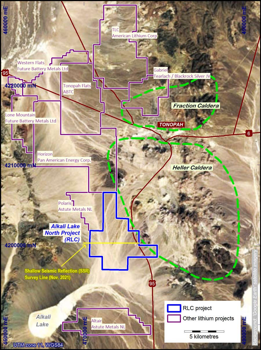
The project is located on the western margin of the Heller Caldera near the northern end of the Alkali Spring Valley Hydrographic Basin. The basin extends 30 kilometres in a northwest direction and drains to the south towards Alkali Lake - located 10 kilometres to the southwest of the Alkali Lake North project ("ALN").
ALN was initiated to investigate for lithium-brine in a deep sub-basin interpreted from satellite and gravity data and now buried under recent alluvium (ASX release 30/01/2017 ). The project was expanded to include investigations for lithium-clay in 2023.
The Tonopah area demonstrates two possible styles of lithium mineralisation:
- Lithium enriched brines in Pleistocene lake sediments associated with large-scale basin subsidence (as at Albemarle's Silver Peak to the southwest)
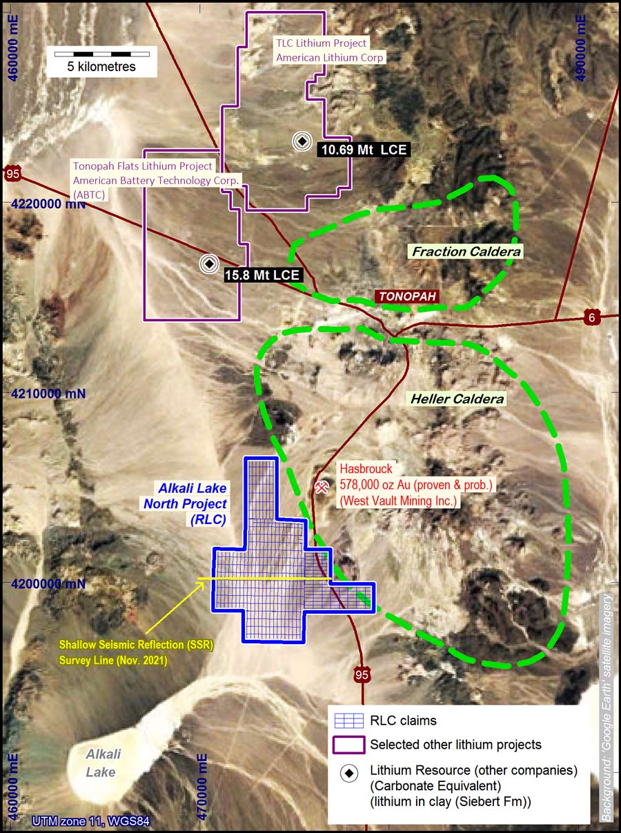
- Lithium enriched clays associated with geothermal activity and volcanic-derived sediments in shallow lacustrine settings (as at a number of nearby projects, including American Lithium Corp.'s 'TLC' project to the north.
The potential sources for lithium in the brine are the metamorphic core complex located 15 kilometres to the west at Lone Mountain and the volcanic stratigraphy including rhyolite and rhyodacite associated with the Fraction Caldera and the Heller Caldera in the Tonopah area.
Lithium enriched clays discovered on projects including several north and west of Tonopah, to the north of ALN, have been reported. The lithium-clay deposits are reported to have good processing characteristics - refer to American Lithium Corp.'s Preliminary Economic Assessment Report dated 17 March 2023 (link provided on RLC's Lithium News page). The lithium in clay discoveries near Tonopah occur within the Siebert Formation, which is characterised by volcanic ash and tuffaceous sediments (refer to RLC's Lithium News page for links to some of these discoveries, and to the location map at the foot of this page). The Siebert Formation is widely distributed in this area and while the presence of lithium in the Formation is not ubiquitous, lithium enrichment is thought to be associated with geothermal activity in shallow lacustrine settings. The Siebert Formation is interpreted to extend into the RLC claims under shallow alluvial cover where it can readily be drill-tested (ASX release 28/04/2023 ).
Lithium-brine targets have been identified by 2-D and 3-D AMT surveys and seismic surveys (ASX releases: 29/05/2017, 28/08/2018, 7/09/2021, 14/10/2021, and 6/01/2022).
Lithium-clay targets comprise clay sediments/tuffs of the Siebert Formation interpreted to extend into the RLC claims under shallow alluvial cover (ASX release 28/04/2023 ).